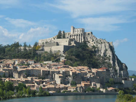
11 - From Authon to Sisteron
11 - From Authon to Sisteron
Gps Track
Gps Track
- Start: Authon
- Arrival: Sisteron
- Total Length: 21,8 km
- Difficulty by Foot: Hard
- Signals: yellow of the PR Tour des Monges – map: 1:25.000, La-Motte-du-Caire 3339 ET ; Sisteron 3339 OT, IGN, France
Hours of walk: 5.30
Rise: 450 m
Drop: 1100 m
Itinerary
The village is left heading west on the carriage road D 3, which is to be followed up to St-Geniez (m 1100), with some occasional shortcuts. Along the way, a board shows the geologic specificities of the Montagne de Mèlan, where more ancient grounds of the tertiary era lay on top more recent ones (red oligocene marl, miocene gres). This territory marks the western border of the Alps. From the village, you go south to link to the GR 6, which then bends towards the west, to go round a calcareous relief, beyond which there is the state forest of Aigues Champs, visible past the ridge. You cross sweet valleys, where sheep and goats pasture. You come across the deserted hamlets of Sorine and Les Naux (1077 m) and then go down towards Sisteron, in the oak wood, on a dirt road with short lengths of asphalt. A first hamlet appears, Le Couvent, and then La Baume. The path leads to the bridge of La Baume, just in front of the Rocher de La Baume, a steep wall of Jurassic lime scale rich in fossils, with a vertical position and heavily eroded: the gorge on the Durance, between the Rocher de La Baume and the historical centre of Sisteron, has since ever been the gate of Provence, well guarded by fortifications. The path leads to the bridge of La Baume, just in front of the Rocher de La Baume, a steep wall of Jurassic lime scale rich in fossils, with a vertical position and heavily eroded: the gorge on the Durance, between the Rocher de La Baume and the historical centre of Sisteron, has since ever been the gate of Provence, well guarded by fortifications.
Food and accommodation
-Various possibilities in Sisteron, in the historical town centre:
Tourist office, Hôtel de Ville,
place de la République 1, tel. 33 (0)4 92613650, www.sisteron.fr.
Hotel restaurant La Citadelle
Rue Saunerie 126, tel. 33 (0)4 92611352, www.hotel-lacitadelle.com


