58 - From St-Girons to Cazavet
58 - From St-Girons to Cazavet
Gps Track
Gps Track
- Start: St-Girons
- Arrival: Cazavet
- Total Length: 12,3 km
- Difficulty by Foot: Easy
- Signals: occasional yellow marks of path 7 up to the Col du Sous – map: St-Girons, 2047 OT, IGN, France
Hours of walk: 3
Altitude gain: 300 m
Altitude loss: 250 m
Itinerary
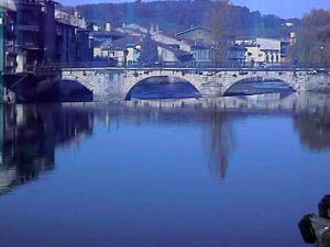
From the old town of Belleville, the route goes across the Pont Vieux on the Salat and then it follows on the right Rue Joseph Pujol in the neighbourhood of Villefranche. You take Avenue Fernand Loubet on the left and follow it until the pedestrian bridge that goes across the river Lez on the right. You proceed on Rue Paul Bert and Rue Paul Verlaine until the T-junction where you take Avenue Alfred de Musset on the left, almost at the suburbs of the town. The road (now Avenue Marcel Pagnol) continues through cultivated fields towards the south-west. After reaching a crossroads of three roads, it is better to follow the road signs to Montégut-en-Couserans, that can be reached by an asphalted road (D 104). After walking across the whole village, the walk continues north following the country route along the edges of the cultivations until the hamlet of Teulariats. Afterwards you follow the country route in the scrub, going up on the left towards the Col de Sous (m 596). From here the route goes on through an unmarked track on the left going down to the Peyréga house, where it meets a track going down to the valley floor. Here the track leads to a road to be followed facing north-west, going straight on at the junction by Bareille (490 m), and again straight on at the following junction with the D 33a. You carry on along the country route that a bit further on turns sharply to the west through a nice rural area to reach Cazavet.
Food and accommodation
In Cazavet:
There are two gîtes: one in town and one at about 1 km from the centre. For reservations:
www.tourisme-midi-pyrenees.com.
Office de tourisme du canton de Saint-Lizier
Place de l’Église, St-Lizier Ariège-Pyrénées tel. 33 (0)5 61 96 77 77, www.ariege.com/st-lizier.
The website of the Ariège: www.ariege.com.


