Hours of walk: 5
Altitude gain: 750 m
Altitude loss: 550 m
Itinerary
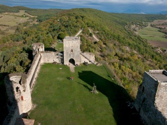
The walk leaves Quillan from the south-west of the old town, proceeding along Rue Baptiste Marcel until the last houses of the village, where there is a rural road to Ginoles, in order to avoid the busier Avenue Maurice Serrault. You cross the whole village and leave westbound on Rue du Château d’Eau, following the path that rises beyond the ridge of the Roc de l’Âne and descends to Coudons. The track goes across a mountain area on wide dirt roads, with many cow pasturelands, soft ridges and a few steep climbs. The route passes near the agricultural hamlet of La Fage, located on a wide intensely cultivated upland. After crossing the D117 road, you reach Nébias. The route goes on following the edges of the upland, along the wide dirt road of the Chemin de Dominique, proceeding on the hillside, parallel to the departmental road. You walk up the wooded ridge to reach the picturesque castle of Puivert.
Food and accommodation
-In Puivert:
Gîte d’étape Le Relais des Marionnettes
In town, in an old hotel, accommodates 30 guests, meal service, use of kitchen, 19 route de Perpignan (D 117), tel. 33 (0)4 68 20 80 69, www.gite-puivert.com .
Chambres d’hôtes La Cocagnière
A 2 km da Nébias, 3, place du Pijol, Campsylvestre, tel. 33 (0)4 68 20 81 90, www.lacocagniere.com .
Office de Tourisme Intercommunal du Quercorb
Cours d’Aguesseau, Chalabre, tel. 33 (0)4 68 69 65 96 www.quercorb.com