44 - From Monze to Lagrasse
44 - From Monze to Lagrasse
Gps Track
Gps Track
- Start: Monze
- Arrival: Lagrasse
- Total Length: 25,1 km
- Difficulty by Foot: Medium
- Signals: white-red of the GR 36, up to the ruins of St-Jean. From the crossroads at a marked altitude of m 357, just past the hamlet of Les Paillasses, there are white-red marks of the GR 36 variant – map: Cazilhac 2346 E e Capendu 2336 O, IGN, France
Hours of walk: 6
Altitude gain: 700 m
Altitude loss: 750 m
Itinerary
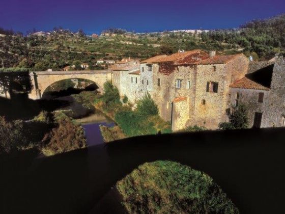
The itinerary proceeds on the GR 36, that goes up to the left of the Cave coopérative (wine growers’ cooperative) along stony paths towards the Montagne d’Alaric, an extended hill covered with low Mediterranean scrub. The route overlooks the steep northern side, facing the valley of the Aude, and it then goes steeply down to Les Bénitiers, that are peculiar chalky monoliths; some of them eroded and have a stoup shape (which gives the name to the place). The path follows the hillside towards the east, passing by the ruins of Les Paillasses, and it then goes on to an asphalted road to be followed on the left to visit the ruins of the castle of Miramont (m 332). After going back to the junction at a marked altitude of m 357, you follow the GR 36 variant, proceeding along the crest and then going steeply down to Roquenégade (m 230), surrounded by vineyards and cultivations. The south-east is then to be followed until Montlaur (m 197), again on a crest among bare scrub. You leave the village on the Route du Pont Neuf by proceeding south-west, and walk up to the upland of the Corbières after going across a stretch of intensely cultivated area. There are numerous pastoral huts (capitèla), with tholos roofing, which underline the pastoral past of this territory which was very strong until the XIX century. A dirt road goes across bare areas, characterised by Mediterranean scrub and garrigue, or sparse pinewoods, and it goes down to the Pont du Sou, where the homonymous stream is to be crossed. You walk for a short while a stretch of the D3 carriageway in order to reach the village of Lagrasse.
Food and accommodation
-In Lagrasse:
Hostellerie des Corbières
6 rooms, meal service, 9 boulevard de la Promenade, tel. 33 (0)4 68 43 15 22, www.hostellerie-des-corbieres.com .
Other options for accommodation can be found in chambre d’hôtes (B&B) in Lagrasse: Office de tourisme du canton de Lagrasse tel. 33 (0) 4 68 43 11 56


