41 - From Minerve to Caunes-Minervois
41 - From Minerve to Caunes-Minervois
Gps Track
Gps Track
- Start: Minerve
- Arrival: Caunes-Minervois
- Total Length: 25,6 km
- Difficulty by Foot: Medium
- Signals: yellow marks only in the central part of this stage – map: Somail Minervois 2444 ET e Peyriac-Minervois 2445 O, IGN, France
Hours of walk: 7
Rise: 500 m
Drop: 500 m
Itinerary
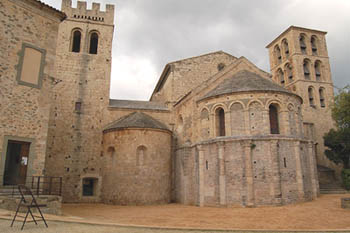
The route leaves Minerve crossing the bridge on the Cesse and the D 10E1 road is to be followed by walking along the Cesse gorges. Just outside Minerve there are some natural arches produced by the stream eroding the chalky rocks. The extraordinary chalky gorges can be seen from the road, covered with sharp pinnacles and cliffs and then the dry bed of the stream on the valley floor. Vineyards increase at the sides of the road. After walking for 4 km on the road, you follow a bend on the right, still walking near the gorges. The rural road finally leads to the D 182, to be followed for 700 m before taking a signed track on the right that goes through the scrub across the upland and then again closer to the gorges. The right is to be kept at the main junctions, still walking along the edge of the upland. The rural road goes once again onto the D 182 (m 430), and you followed it westbound for another 700 m. The route goes left at the junction and it proceeds straight on at the first crossroads. At the second junction (399 m altitude), you turn left on the signed rural road through the scrub and sparse cultivations. It then meets the D 12, to be taken on the left. At the following junction you turn right, where there is the Oratoire de St-Benoit. You follow the asphalted road until Félines-Minervois (m 159), almost reaching the valley. You cross the village and, on the west, take Rue de Brama. The route proceeds westbound at a junction and reaches the wood of Jappeloup. At the edges of the wood there is a track heading southwest and, by keeping this same direction, the following junctions can be ignored until Chapelle de St-Roch (m 156); here the road goes southbound to shortly reach Trausse (m 152). The itinerary leads across the village and it is left behind heading towards the southwest on Rue de Laprade. You turn right at the first junction after leaving the village, following the road that turns westbound and goes across the bridge on the river Cros; the route then proceeds towards the northwest and goes straight on at all the junctions until Le Viver. Behind the house a track goes down to the gorges of the river Argent-Double and meets an asphalted road just before Caunes-Minervois.
Food and accommodation
-In Caunes-Minervois
Gîte d’étape Le Relais Saint-Genès
12, avenue du Minervois, meals served upon reservation, tel. 33 (0)4 68 78 02 81, www.gite-minervois.com
Various options for food and accommodation can be found in town. For information: Office du Tourisme de Caunes Minervois, Place de l’Église, tel. 33 (0)4 68 78 09 44.