34 - From La Couvertoirade to Montagnol
34 - From La Couvertoirade to Montagnol
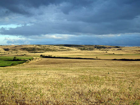
Gps Track
Gps Track
- Start: La Couvertoirade
- Arrival: Montagnol
- Total Length: 34,8 km
- Difficulty by Foot: Hard
- Signals: white-red ones of the GR 71 C up to le Pas de Tirecul. No marks until Montagnol – map: Le Caylar 2642 O e Camarès 2542 O, IGN, France
Hours of walk: 8,30
Rise: 750 m
Drop: 900 m
Itinerary
From the western side of the walled hamlet you take the D 55 and walk for 500 m to then proceed on the Causse. You go under the A 75 highway just before the village of La Pezade. You then pass near Canals (m 66), through nice rural areas, in the heart of the Parc Naturel Régional des Grandes Causses. The GR 71 C then reaches Le Mas Reynal (m 748) and the Pas de Tirecul (m 804). The marked route going northbound is to be left to proceed towards the southwest on tracks through the scrub until the Jasse de Peyre, a sheep fold where water can be found in a closed tank among trees, in front of the house. From the fold, you follow the west until the Pas Farrat (m 796) and then leave the upland and descend to a dirt road at an altitude of m 687. You walk southbound on it for about 500 m, in order to reach the D 93 carriage road that leads to Tournadous (m 642). After leaving the village and walking for 300 m, you turn right at the crossroads by going along the second (out of 4) road pointing westbound. When you reach a crossroads at a marked altitude of 688 m you turn right and, after walking beyond a Télécom mast, you go up to the crest reaching Serre Pountchut (m 752). The route proceeds along the crest; there are just a few trail marks at the beginning, but they increase along the path. You then reach the crossroads at an marked altitude of m 713 in order to go down to the left through the state forest of Montpaon. The twisting track is to be followed, always keeping to the main path when meeting other junctions. After leaving the state forest (reforestations), you keep straight on at the first crossroads (of four roads) and then always turn right at the two following junctions, proceeding towards the northwest and then definitely westbound. The route passes near the house La Joncasse and then goes down along the valley floor of the stream Le Dragou up to just before the houses of Laval. You then walk up a path on the right that goes across the wood and reaches the upland, where there is a more visible track through the fields that is to be followed westbound until Le Mas de Salel and then up to Montagnol.
Food and accommodation
-In Montagnol:
B&B Le Mas de Salel
On the route, at 1 km from Montagnol, in a nice country building of the XVIII century. With restaurant; accommodates 20 guests, tel. 33 (0)5 45 97 55 45.
Town hall: Mairie di Montagnol, tel. 33 (0)5 65 49 59 19
Syndicat d’initiative des 3 vallées
9, Grand Rue, Camarès, tel. 33 (0)5 65 49 53 76.