Hours of walk: 8
Rise: 650 m
Drop: 1200 m
Itinerary
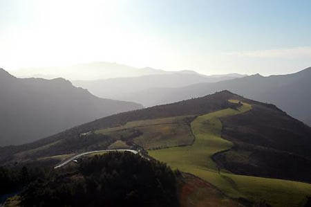
The GR 67 leaves the carriage road D 983 on the west of the village to skirt and climb the woody rise of La Can Noire. The route then goes on along the ridge until the Corniche way is reached, leading to Hospitalet. The itinerary proceeds from the hamlet along the route of an ancient dralha, a track for transhumance which runs along the ridge through a beautiful environment with pastures and enclosed meadows with animals. After the Col Salidès, you follow a forest track and equestrian path up to Aïre-de-Côte (1089 m), where there is an equestrian gîte (hostel). The walk then overlooks the Vallée Borgne, characterized by steep woody sides, with outcrops of gneiss. It then crosses chestnut tree woods with monumental trees, and then the landscape becomes more Mediterranean with holm-oaks and low scrub, while going down to the bottom of the valley and to Vallerougue.
Food and accomodation
-In Valleraugue:
Gîte le Cagnel
In the west of the town, on the main road crossing IT (d 986), meals upon reservation, open from april to november, host 32 guest tel. 33(0)4 67 82 24 12
Office du turisme de Vallerougue – Mont Aigoual
Quartier des hortes, Vallerougue tel. 33 (0)4 67 82 25 10