28 - From Le Pont de Montvert to Florac
28 - From Le Pont de Montvert to Florac
Gps Track
Gps Track
- Start: Le-Pont-de-Montvert
- Arrival: Florac
- Total Length: 29,0 km
- Difficulty by Foot: Hard
- Signals: white-red marks of the GR 70 – map: Mont lozère 2739 OT, IGN, France
Hours of walk: 7,30
Rise: 800 m
Drop: 1150 m
Itinerary
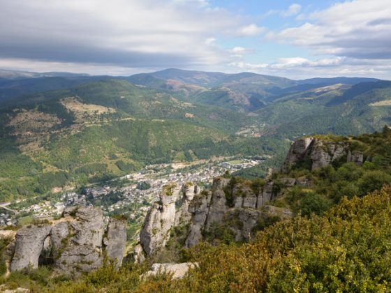
The walk leads across the bridge on the Tarn river, going on towards the south and up along a steep mule track with a panoramic view over the village. A number of ups and downs allow to cross the Cham de l’Hermet, a wide plateau dedicated to grazing, where walkers pass by the ruins of ancient farms, one of which still preserves the remains of its rye straw roof. From Pont de Fiarouse (1036 m), you follow the asphalt up to Champ Long de Bougès (1089). From this point a steep rise across the forest leads to the Col des Trois Fayards. The itinerary leads further up, along a meadow ridge to the Signal de Bougès, where the walk is marked by little stone men and semicircular stone shelters to protect walkers from the wind. You walk up the long meadow crest, amidst sheep flocks, up to Col du Sapet (1,080 m), where there is a menhir. You go on along forest tracks, now on one side of the ridge, then on the other, passing by the cols of l’Ancise (1026 m) and de Perpau (952 m). You then descend to the Tarn river, beyond which the route goes on along the river on the right side of the mountain, before the hamlet of Bédouès (m 588) which comes into sight. After crossing another bridge on the Tarn, the itinerary covers a short length on the N 106 road, to then enter the town of Florac.
Food and accommodation
-In Florac:
Gîte communal de Florac
Located in rue du Four, a kitchen is at the guests’ disposal and meals can be served upon reservation. It is always open and accommodates 29 guests, tel. 33 (0)4 66 45 23 98.
Centre d’Accueil Cévennes
Holiday resort with a climbing practice wall and other sports facilities. It has a kitchen at the guests’ disposal and meals upon reservation; 1 place du Saguenay, tel. 33 (0)4 66 45 23 98
Other options for food and accommodation can be found in town.
Office de Tourisme de Florac, 33 Avenue J. Monestier, tel. 33 (0)4 66 45 01 14.


