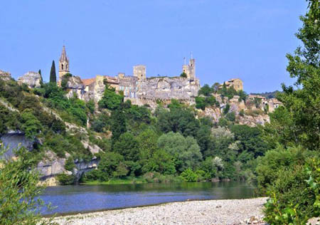
21 - From Pont-St-Esprit to Aiguèze
21 - From Pont-St-Esprit to Aiguèze
Gps Track
Gps Track
- Start: Pont-St-Esprit
- Arrival: Aiguèze
- Total Length: 11,7 km
- Difficulty by Foot: Easy
- Signals: white-red of the GR 4 – map: Bagnols-sur-Cèze 2940 OT ; Gorges de l’Ardèche 2939 OT, IGN, France
Hours of walk: 3
Rise: 150 m
Drop: 100 m
Itinerary
The GR 4 track leaves Pont-St-Esprit leading towards the north-west along an asphalted road across the cultivated fields of the Rhone valley. Following the ways of the Chemin du Calvaire, and then the Chemin des Mines and the Chemin des Sables, the path touches the hamlets of Ventebren, La Sauvanne, and le Pigeonnier. The route then leads north of the town of St-Paulet-de-Caisson, and, just past it, following the Chemin de la Plane, there is the Romanesque chapel of Ste-Agnès which is worth a short detour to the secluded hill where it stands. St-Julien-de-Peyrolas (142 m) is a settlement on a small panoramic relief and can be reached through country roads going along fenced off cultivated land and meadows where horses graze placidly. The route continues leaving the village from its northern side and following the D 901 road for a short distance, to then proceed along the river Ardèche, an affluent of the Rhone. The beautiful suspended bridge of St. Martin-d’Ardèche now appears in sight; it was built in 1905 after a devastating flood had destroyed the stone bridge inaugurated just a couple of years before. You carry on along the right bank of the river, without crossing the bridge. There are amazing views over the gorges below and on the beautiful settlement of Aiguèze, which can be reached through a short, but suggestive, rocky path.
Food and accommodation
-In Pont-St-Esprit: (see chapter 2)
-In Aiguèze:
Camping Les Cigales
In La Blainchisserie, not far from the suspension bridge, tel. 04 66 82 18 52. Accommodates 40 guests, always open.
Other options for food and accommodation can be found in the historical centre. Info point of Aiguèze: 04 66 39 26 89; Office du tourisme de Valcézard (Goudargues), tel. 33 (0)4 66 82 30 02


