Hours of walk: 5
Rise: 600 m
Drop: 700 m
Itinerary
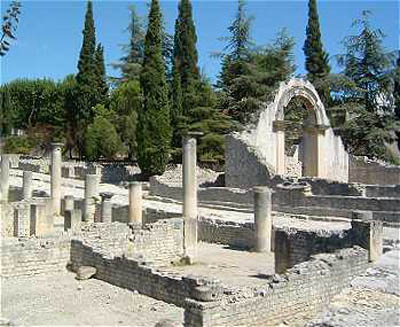
The village of Malaucène is left from its southern side, where there is the Church of Saint Michel. The route leads then to the crossing of the plain of the torrent Groseau, walking mainly on scarcely trafficked asphalted roads, following the Avenue de la Libération, and then the Chemin de Col de Ronin. You then follow the D 938 for a short while, at a great bend, and then you leave it and turn right on a road leading to the feet of the rise of Les Gippières which you cross through a saddle at 472 metres of altitude. The itinerary goes on along the hillside in a Mediterranean environment, in the holm-oak grove and in unexpectedly wild places. In this place, the limestone and the particular flora typical of these karstic grounds also prevail. You then cross the D 90 at the Col de la Chaîne (470 m), and leave it almost immediately to follow, through many ups and downs, the Pas du Loup (579 m), where the GR 4 is left for the GR de Pays -Tour des Dentelles de Montmirail, a group of mountains which is clearly visible to the west. You carry on towards the north-east, and then up to the north in order to join the access road to the village of Crestet (380 m), in a beautiful position on a sharp edged ridge, the last offshoot of the Dentelles de Montmiral. The route leads down into the valley to the west of the village, along a dirt road in the woods with a view over a small fortified village on the ridge. Serre Longue (385 m) is thus reached, to then go on up to Vaison-la-Romaine, with a last panoramic length on its Haute-Ville, among the vineyards. You enter the labyrinth of the paved streets of the Haute-Ville, the high medieval town, rich in fountains and fine restored houses, and then descend to the Gallic-Roman bridge (I century A.D.) on the river Ouvèze leading to the lower part of the town. A plaque commemorates the floods of 1992, when a wave of 17 metres submerged the bridge without damaging it.
Food and accommodation
-In Vaison-la-Romaine:
Hotel Burrhus
1, Place Montfort, tel. +33 (0)4 90 36 00 11;
38 rooms, decorated with contemporary art; www.burrhus.com.
Office de Tourisme
Place du Chanoine Sautel B. P. 53, tel. +33 (04) 90 36 02 11, www.vaison-en-provence.com.
Many options for food and accommodation can be found in town.