Hours of walk: 4,30
Rise: 650 m
Drop: 750 m
Itinerary
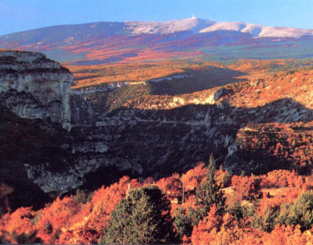
The itinerary continues along the hillside with many ups and downs, at the base of Mont Ventoux. It goes across numerous combes, deeply eroded in the calcareous rock. The environment is typically Mediterranean and the walk is pleasant through woods of Aleppo pines, holm-oaks and arbutuses. The route then ascend steeply in the Combe Obscure where there are calcareous walls suitable for climbing. The ascension continues through a coniferous forest, reaching a saddle where you cross the D 974 for Mount Ventoux. The walk carries on along a path uphill to the chapel of Piaud (698 m). A precipitous descent leads to the D 974 road: you just cross it to then find it further below where it leads you to the centre of Malaucène.
Food and accommodation:
-In Malaucène
Hotel L’Abri du Ventoux
19 cours des Isnards, tel. +33 (0)4 90 65 27 08, 30 rooms, garage for bicycles, restaurant. www.abriduventoux.com.
Office de Tourisme
3, Place de la Mairie, tel. +33 (0)4 90 65 22 59, www.malaucene.fr. Many options for food and accommodation can be found in town.