Hours of walk: 6
Rise: 1250 m
Drop: 1550 m
Itinerary
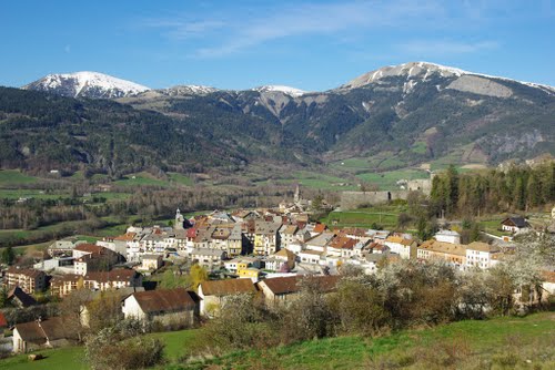
A track marked as GR 6 leads from the Abbaye de Laverq to the hamlet of Clarionds (1450 m), which is still inhabited. There is a farm (goats breeding and cheese production) which manages the stopping place of the Abbaye de Laverq. The route then descends to the valley floor through an asphalted road leading to St-Barthélémy (1238 m), another rural hamlet surrounded by fenced meadows. The GR 6 carries on towards the Col de Bernandez (2304 m), on the Montagne de La Blanche. The landscape is stunning: at the head of the valley a glacial cirque opens, in a calcareous environment. The descent from the col is on a steep slope through a track across the mixed larch wood, where there also are hooked pine trees. The path leads to the hamlet of St-Pons (1361 m), surrounded by fenced meadows in an intact rural context. Then a short way on the carriage road D 607, leads to the village of Seyne-les-Alpes (1260 m). It is common to see gliders flying during this descent. Seyne, in the valley of the Blanche, actually has a highly regarded gliding field.
Food and accommodation
-In Seyne-les-Alpes:
Gîte d’étape Norella
loc. Greyère Basse, at about 2 km south of the village, tel. 33 (04) 923227200, mobile 06 07404493; france-norella@wanadoo.fr
Other options for food and accommodation in Seyne:
Tourist office Place d’Armes, tel. 33 (0)492351100
