Hours of walk: 3,30
Rise: 1100 m
Drop: 300 m
Itinerary
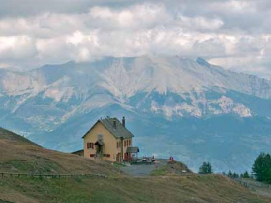
The itinerary goes on, ascending above the historical centre of Allos, firstly on the D 908 carriage road for a short while, and then climbing up and touching the hamlet of Le Pont (m 1470), until you overlook on the valley of the Chancelaye torrent, among splendid fenced pastures: the valley hosts huge sheep flocks (hundreds of animals). The landscape is characterized by interesting erosion phenomena: black ravines (calanques) in the marl rock. You walk up to the col of the Baisse de Prenier (2350 m), to then go on along the mountainside up to the Col d’Allos (2247 m). Slightly below the road passage there is the refuge of the Col d’Allos, which is oddly without drinking water and electricity.
Food and accommodation
Refuge du Col d’Allos
Tel. 33 (0)4 92838514, cell. 33 (0)6 80 62 61 15; accommodates 40 guests.