Hours of walk: 5.30
Rise: 1900 m
Drop: 750 m
Itinerary
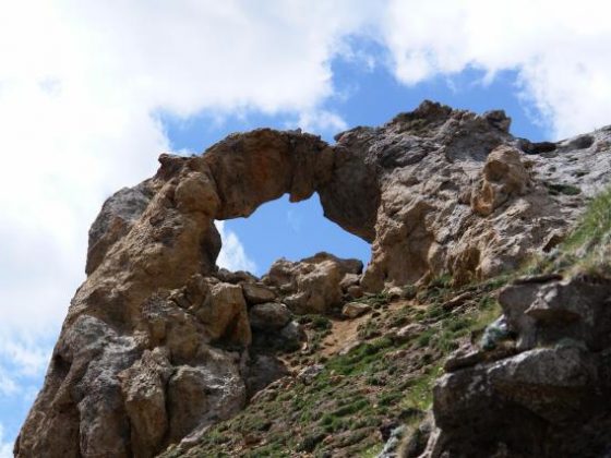
From Pietraporzio, the walk carries on along a track on the right side of the Stura valley, opposite to the side where the SS21 passes, up to Pontebernardo (1312 m). A steep track above the hamlet ascends to the Colle del Ferro, passing by the small village of Murenz (1567 m), and going round the northern face of the peak of Auta di Barel (2412 m) up to the col of Becco Rosso (2253 m) to then descend to the floor of the narrow valley of Forneris. You now walk on the left side of the valley and go up touching the Gias del Bal. The rise gets steeper up the Colle del Ferro (2584 m), which marks the border with France and with the pas of Mercantour. A path along the mountainside leads to the following Collet de Tortisse (2591 m), from which you descend swiftly to the refuge and the lakes of Vens (2366 m). It is worth to notice the beautiful natural arch of Tortisse on the col.
Food and accommodation
Refuge des lacs de Vens
tel. 33 (0)6 07412158; Caf des Alpes-Maritimes, tel. 33 (0)4 93625999; open from mid June to the end of September; accommodates 40 guests.